Sign up for the Family Tree Newsletter Plus, you’ll receive our 10 Essential Genealogy Research Forms PDF as a special thank you!
Get Your Free Genealogy Forms
"*" indicates required fields
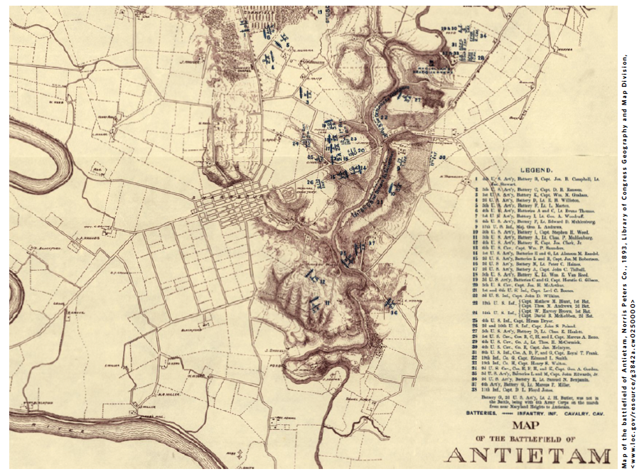
Military maps are invaluable for learning about ancestors who served in the armed forces. If you know a soldier’s service dates and regiment, you can determine the regiment’s whereabouts in a battle. On this 1893 map of the Antietam battlefield, numbered marks indicate Union command posts. Military maps also could aid in researching nonmilitary ancestors: This one has landmarks (e.g., “Dunker’s Chapel”) and landowners’ names.
As with other historical maps, you can better understand old military maps by comparing them to modern maps using tools such as Google Earth.
Military maps’ contents and availability vary. The Library of Congress (LOC) has a robust collection from the 1700s to today. Search for a battle or location, or browse LOC collections focused on the American Revolution, the Civil War or World War II.
ADVERTISEMENT