You’ve just learned where your great-great-grandfather is buried, and you’d like to make a trip to the grave site. But you’ve never visited the cemetery, and trying to read a map (especially one with tiny print) while you drive can be a little scary — for you and your fellow road warriors. Luckily, thanks to Global Positioning System (GPS) technology, you don’t need a good sense of direction or an extra set of eyes to find your destination.
Developed by the US Department of Defense, GPS is a network of 24 satellites that orbit the earth and constantly measure and broadcast their positions. A GPS receiver then collects the satellites’ signals to determine your current location. In recent years, a number of companies have developed affordable GPS devices that you can use to get to an appointment in an unfamiliar neighborhood or even find your ancestor’s county courthouse across the country. These devices can work with your laptop computer or personal digital assistant (PDA), or you can buy a stand-alone handheld GPS device. Read on for help finding one that will work for you.
Basic necessities
The price of GPS receivers ranges from about $100 for the most basic handheld device, such as Magellan’s GPS 310 <www.magellangps.com>, to more than $1,000 for a souped-up stand-alone, such as Garmin’s StreetPilot 2610 <www.garmin.com>. Most laptop and PDA devices fall in between.
Many mapping programs include directions to points of interest such as hotels, gas stations and restaurants. Programs such as Street Atlas USA also can point you to libraries, museums, cemeteries and historic sites — a perk for genealogists. Before purchasing a program, you might want to contact the developer to see what points of interest the software identifies. This feature can be a time saver and may enhance a research trip by alerting you to nearby attractions.
Laptop companions
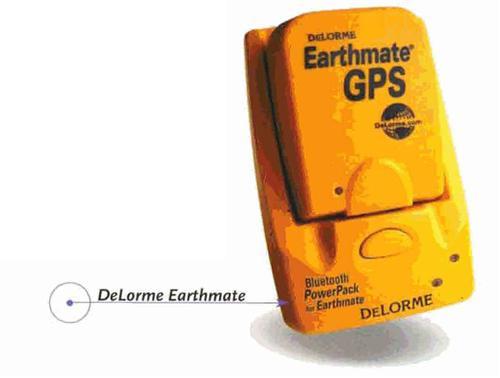
For years, my husband and I relied on a DeLorme GPS device to keep us from getting lost on car trips. The device was about the size of my hand and connected to a serial port at the back of our note-book computer. We’d set the GPS receiver on the dashboard, and the laptop on the passenger seat or on the passenger’s lap.
You also don’t need to worry about whether your GPS device is compatible with your computer — a problem that arises with PDAs. As long as your laptop meets the soft-ware’s system requirements, you’re good to go. Just plug the GPS device into your laptop’s serial port.
Size matters
PDA-compatible GPS receivers are a great alternative because of their compact size. Just remember that not all GPS receivers will work with your PDA. ALK Technologies <www.alk.com>, Deluo <www.deluo.com>, Destinator <www.destinator1.com> and TeleType <www.teletype.com> all provide detailed information about which PDAs are compatible with their products. And some bundle GPS receivers with mapping software, so you can get an entire GPS system in one package.
The biggest problem with PDAs is their limited memory. Although they’re conveniently small enough to take anywhere, their memory won’t hold a lot of maps. So before you set out on a road trip, you’ll have to download the necessary maps to your PDA and make sure they’ll all fit.
When you shop for a PDA-compatible GPS receiver, I strongly recommend finding a device with an external antenna that sits on your car’s dashboard. That way, you can view the PDA without losing the satellite signal, which won’t transmit through the car’s roof.
All by themselves
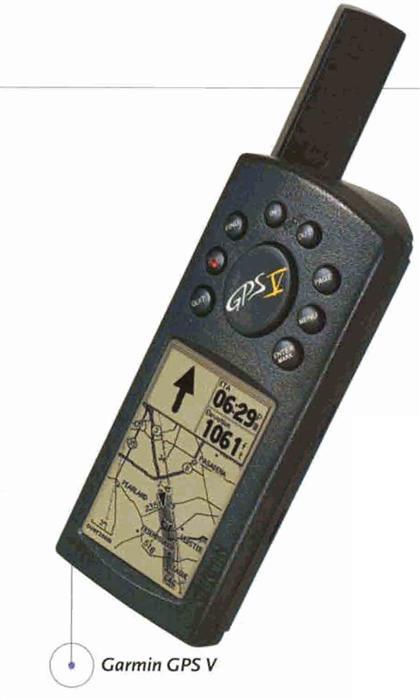
Stand-alone GPS devices are popular with boaters, hikers and campers because of their durability and portability. Some are even waterproof. Although you may not save money with these devices — some cost more than a PDA and GPS device combined — you can leave them in your car at all times.
Black-and-white screens may lower the cost, but they also may be harder to read when you’re driving in bright sunlight. I’ve had good luck with Magellan’s Meridian products, especially the Meridian Marine, which costs $359.99. Although it has a black-and-white screen, it’s readable on both land and sea. I’ve used it as a stand-alone, as well as with my laptop (using an adapter cable) for extended driving trips. Other developers of stand-alone GPS products include Garmin, Lowrance Electronics <www.lowrance.com> and Navmau <www.navman.com>.
On the road again
Once you’ve used GPS technology to find an ancestor’s grave, farm or county courthouse, make note of the place’s latitude and longitude. That way, you can easily return to the site and provide family members with detailed directions. Thanks to that handy GPS device, you may never get lost again.