If your relatives served early in World War I, they may have participated in an unlikely peace between the Central and Entente powers. On Christmas Day, 1914, WWI combatants emerged from their trenches to shake hands, exchange souvenirs and play soccer. WWI maps can tell part of the story—specifically, how the peace couldn’t last.
When war broke out in 1914, many expected the conflict to end by the new year. German, British and French soldiers, likely surprised to still be far from home on Christmas Day, arranged for a ceasefire to commemorate the holiday.
Some soldiers even recalled singing Christmas carols across No Man’s Land (the area between the front lines, guarded by land mines and riflemen). The British verses of “Silent Night” mingled with the Germans’ “Stille Nacht.” While we remember World War I for its horrific violence, the “Christmas truce” reminded the two sides of their shared humanity. Maybe your ancestor, caught up in the holiday spirit, offered the “enemy” a cigar.
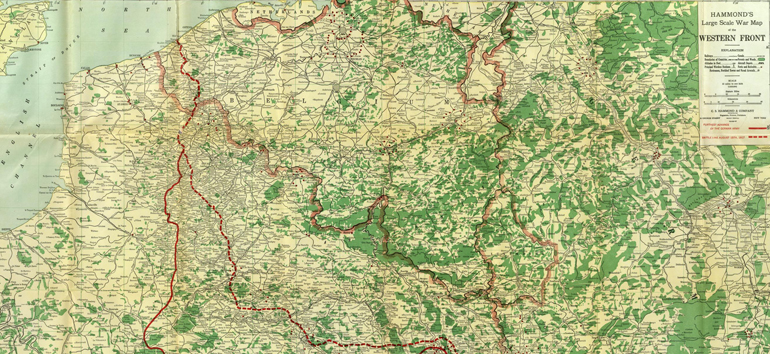
Unfortunately, the peace couldn’t last. This map displays the infamous Western Front a few years later in 1917, after millions had died. For much of the war, French and British troops were locked in a stalemate with the invading German army.
In the map above, the solid red line represents the furthest German advance, while the dotted red line represents the front at the time of the map’s creation. If you have ancestors on either side of the war, they may have fought or died in the territory outlined.
You can find this and other great WWI maps online at the David Rumsey Map Collection. The National Library of Scotland has also digitized zoomable WWI maps of British and German trenches.