The Library of Congress (LOC) in Washington, DC, is the biggest library in the world. It would take nearly 12 days of nonstop walking to trek all 838 miles of bookshelves. Its vaults are home to 5.5 million maps and more than 14 million photos and prints.
Fortunately, it’s getting easier to access LOC holdings without making a trip to the nation’s capital. The LOC has been putting digitized collections online since the mid-1990s, with rare and unique items taking priority—and that includes maps and photos. While you might not find a picture of an individual ancestor (although it doesn’t hurt to try), you could find photos and maps of your ancestors’ hometowns, schools, churches and more. Here’s how to get them.
Photos
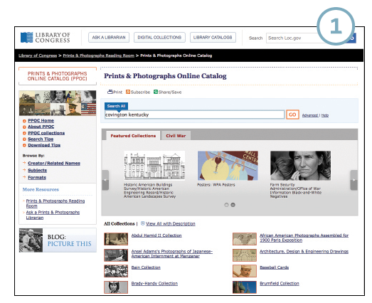
1. Start your search in the Prints and Photographs Online Catalog <www.loc.gov/pictures>, which points to about 95 percent of the LOC’s total collection—whether digitized or not. The basic search finds your terms in any part of an item description. Try a variety of keywords, such as surnames, places, street names, ethnicities, military units, schools, employers, social clubs, etc. You can use wildcard characters, including ? (to replace a single unknown character) and * (to replace multiple letters within or at the end of a word). Don’t put phrases in quotes.
Click Advanced Search if you want to search for an exact phrase or for any of multiple terms you type (similar to an OR search). The Advanced search also lets you search specific fields in items’ descriptions, whether to search select fields and whether to allow variations.
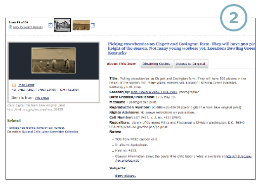
2. Clicking on a search result will take you to a page (in a new window—handy so you don’t have to keep hitting the back button) with an image thumbnail and details about it. You’ll often be able to view and download a larger image; if not, it means the image isn’t available online.
Check this page for links that lead to more information about the photo, and additional or higher-resolution images. Want to find related images? Click on a link under Subjects to look for other items to which LOC catalogers have assigned this subject term.
You’ll also see rights information, which helps you learn about any restrictions on how you can use the image, and what repository to contact if you need the copyright owner’s permission.
Maps
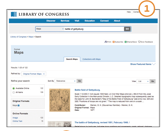
1. Nearly 14,000 digital map images are among 400,000 items listed in the LOC’s Geography and Map Division online catalog (which is still a fraction of the 5.5 million maps and 80,000 atlases the LOC holds). Start your search at <www.loc.gov/maps> (note that Maps is automatically selected as the format next to the main search box).
As with photos, the search finds terms in any part of an item description. You could search for a city, county, state or other geographic name; a war or battle to find military maps; or a rail company to find railroad maps.
There’s no advanced search option here. Instead, you’ll type your search term and then use the filters along the left side of the page to narrow your search. Refine search options. You can choose to view matching items by dates; choose a century then, optionally, a decade and/or a year from the subcategories that appear. You also can filter items by location, contributor or author, and LOC subject term. As you add filters, you’ll see them show up at the top of the page under the Results header. Click the X next to the name of a filter to remove it.
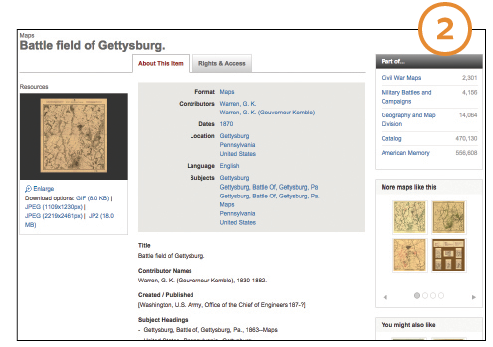
2. When you follow on a search result, take a minute to look over the information about the map. You’ll learn when it was published, by whom and for what purpose. Clicking on any of the linked terms in the gray box at the top will run a search for that term.
Under “Part of …” on the right, you’ll see links to collections this map is associated with. Below that, you’ll see thumbnail images for “More maps like this” and “You might also like.” These could lead you to other maps related to your search.
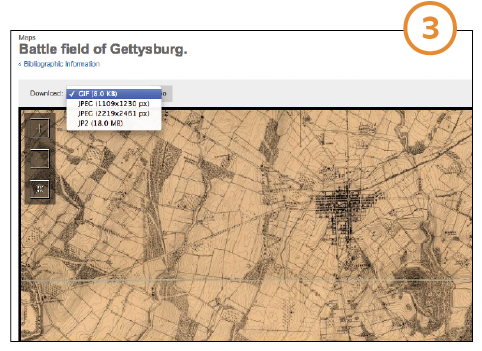
3. Click the map thumbnail on the left for a larger view. This takes you to a viewer where you can zoom in and pan around. Depending on the item, you might see options above this enlarged map image to download it in a range of formats, resolutions and sizes.
Once you’ve used this route to explore the LOC’s photo and map collections, browse around the site’s American Memory Collection <
memory.loc.gov>. This is a free portal to US history topics such as women’s history, military and war, religion, African-American history, immigration, cities and towns, and more. American Memory overlaps with the LOC catalog, but includes digitized materials from other institutions as well.
In addition, check out the LOC’s photostream on Flickr <
www.flickr.com/photos/library_of_congress>, a free photo-sharing service. Do simple keyword searches in the Flickr search box, which has a drop-down option that lets you choose whether to search all of Flickr or just the LOC images.
From the October/November 2015 issue of Family Tree Magazine
